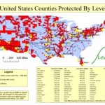
Populations in U.S. counties that are protected by levees. Researcher Ezra Boyd created the map using data set provided by FEMA and 2000 census information.
The eye-popping map is featured in the segment called “Off the Beaten Path” that highlights interesting geographic information systems (GIS) applications.
This great exposure to geospatial professionals across the nation should help to open some more eyes and spur additional efforts to hold the Corps accountable in New Orleans and beyond.


Leave a Reply